
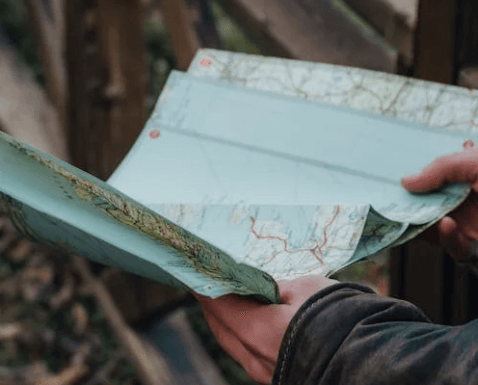
Are you wondering, “How to get a topographic map of my property?” You’re not alone. Topographic maps are essential tools for property owners, offering detailed information about natural features like elevation changes, waterways, and slopes that can influence land use. Did you know that the U.S. Geological Survey (USGS) has created over 54,000 detailed maps, covering nearly every corner of the United States? These maps are invaluable for planning construction projects, managing drainage, or simply understanding your land better. Experts like Steve Daria and Joleigh, renowned real estate investors and land buyers for cash, emphasize the importance of a topographic map for maximizing your property’s value and potential. Whether you’re buying or developing land, these maps can save significant time and money by revealing critical site details. Curious about “How to get a topographic map of my property?” Reach out to Steve and Joleigh today to book a free discussion and start making informed decisions about your land investment.
Key Points
- Understand What a Topographic Map Shows: A topographic map displays details like elevation, slopes, and natural features of your property. This information is crucial for planning construction or managing land effectively.
- Access Free Online Resources: Websites like the U.S. Geological Survey (USGS) offer free downloads of topographic maps. These digital tools allow you to locate and view detailed maps of your property quickly.
- Use Mapping Applications: Apps and software like topoBuilder can create custom maps with contour lines and specific features. They provide an easy way to visualize your land’s terrain and structure.
- Consult Professional Surveyors: Hiring a licensed surveyor is a great option for precise and up-to-date data. They can conduct a detailed topographic survey tailored to your property needs.
- Contact Experts for Guidance: Seek advice from professionals like Steve Daria and Joleigh, renowned real estate investors and cash land buyers. They can help you obtain a topographic map and make the most of it for your land investments.
What is a topographic map, and why do I need one for my property?
A topographic map shows natural and man-made features of land, including elevation and contour lines.
These maps are incredibly useful for property owners because they provide a clear picture of the land’s shape and structure.
Understanding your property’s terrain can be crucial for planning construction projects, managing drainage issues, or estimating property value.
For example, if you’re thinking about building a home or installing a fence, knowing the slope and elevation of your land can save you time and costly mistakes.
If you’re wondering, “How to get a topographic map of my property,” there are several ways to do so, including using online resources such as the U.S. Geological Survey (USGS) or hiring a professional surveyor for more accurate and customized data.
These maps are also helpful for outdoor activities like hiking or hunting, giving you a better understanding of the lay of your land.
Additionally, having a topographic map can be vital in areas prone to flooding, as it enables you to identify low-lying regions easily.
Whether you own a small residential lot or a large tract of land, having access to a topographic map ensures you make informed decisions.
Learning “How to get a topographic map of my property” is a practical step toward maximizing the potential of your land.
Get Started: Get Your Cash Offer Below…
We are direct land buyers. There are no commissions or fees and no obligation whatsoever. Start below by sharing where your property is and where we can send your offer…
Are there free resources available to access topographic maps?
Yes, free resources are available to access topographic maps, making it easier than ever to learn how to get a topographic map of my property.
One of the most well-known sources is the U.S. Geological Survey (USGS), which provides free downloads of topographic maps through its online platform.
Their database, known as The National Map, offers maps with detailed contour lines, landmarks, and elevation data, which you can search by specific locations.
Another great option is state or local government websites that often provide free topographic information for public use through geographic information system (GIS) data.
For more interactive experiences, apps and platforms like Google Earth and OpenStreetMap allow you to explore the basic topographic features of your land.
While these free resources are convenient, they may not always give you the specific details you need for projects like construction or legal purposes.
You can pair free tools with paid services for more comprehensive maps if you need higher accuracy.
Knowing these resources helps you take the first step in discovering “How to get a topographic map of my property” without breaking the bank.
Start exploring these options today to understand your land’s features better and make well-informed decisions.
What tools or software can help create a custom topographic map?
- QGIS: QGIS is a free and open-source software that helps you create detailed custom maps, including topographic ones. It provides a variety of tools to seamlessly incorporate contour lines, elevation data, and geographic features into your map.
- ArcGIS: ArcGIS is a powerful mapping software widely used by professionals to design custom maps. It allows you to work with highly accurate geographic data, including terrain elevation, slopes, and water features specific to your property.
- Global Mapper: Global Mapper is an easy-to-use GIS program designed to create high-quality topographic maps. It offers features like 3D visualization and advanced elevation tools that can help you customize your map more precisely.
- Google Earth Pro: Google Earth Pro allows users to explore topographic features and add custom notes or markers to maps. While it’s not as advanced as other GIS tools, it can be used for basic customization and visualization of your property’s landscape.
- TopoFusion: TopoFusion specializes in creating topographic maps with GPS data, making it perfect for outdoor enthusiasts and property owners. It allows you to upload GPS tracks and layer them with elevation and contour details to create a comprehensive custom map.
Should I hire a professional to get an accurate topographic map of my land?
Hiring a professional to get an accurate topographic map of your land is often the best choice, especially if precision is important for your project.
Professional surveyors have the right tools and expertise to measure elevation, slopes, and boundaries accurately.
This can be crucial for construction, legal disputes, or land development where even small errors can lead to costly issues.
If you’re wondering “How to get a topographic map of my property,” a licensed surveyor can guide you through the entire process.
They use advanced equipment like GPS systems, drones, or laser scanners to create a detailed map tailored to your land.
While free or online resources are available, they might not provide the level of detail or reliability you need.
Professionals also ensure the map meets local or legal requirements, which can be important for permits or zoning rules.
Although hiring a surveyor can be more expensive upfront, it’s often a worthwhile investment to avoid potential problems down the road.
Professionally crafted topographic maps give you the clarity and confidence to make informed decisions about your property.
What should I consider when choosing a topographic mapping service?
- Accuracy of Their Equipment and Methods: The first thing to check is if the service uses modern, accurate tools like drones, GPS systems, or laser scanners. This ensures you get the precise data you need when learning how to get a topographic map of your property.
- Experience and Qualifications: Pick a service with skilled professionals who have a proven history of creating quality topographic maps. This can save you time and ensure the best results in your quest for “How to get a topographic map of my property.”
- Understanding of Local Regulations: A good service provider will also be familiar with your area’s zoning laws and permitting requirements. This is essential when determining how to get a topographic map of your property that meets legal standards.
- Turnaround Time: Ask how long it will take to deliver the final map, especially if you’re on a tight schedule. A reliable service can help you avoid delays in your property plans or building projects.
- Cost and Transparency: Compare prices and ensure no hidden fees before committing. A transparent provider will give you a clear breakdown of costs so you know you’re getting value for the service.

What information do I need to locate a topographic map of my land?
You’ll need some essential information to get started to locate a topographic map of your land.
First, it helps to know your property’s exact address or legal description, as this allows you to pinpoint the location accurately.
You should also understand the property size and boundaries, which can influence the scale of the map you need.
Coordinates like latitude and longitude can be useful, especially if you’re looking for digital mapping options.
Additionally, consider any unique features of the land, such as rivers, slopes, or elevations, that you want the map to highlight.
For those asking, “How to get a topographic map of my property,” Gathering this information can simplify the entire process.
If you’re uncertain, seasoned real estate investors and cash land buyers Steve Daria and Joleigh are here to offer their expert guidance.
They specialize in helping property owners make better decisions with valuable insights and resources.
Call them today to take the next step in understanding your land better!
**NOTICE: Please note that the content presented in this post is intended solely for informational and educational purposes. It should not be construed as legal or financial advice or relied upon as a replacement for consultation with a qualified attorney or CPA. For specific guidance on legal or financial matters, readers are encouraged to seek professional assistance from an attorney, CPA, or other appropriate professional regarding the subject matter.