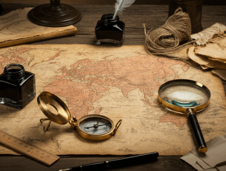
Cartography, the study and practice of making maps, is an integral part of understanding the world around us. According to the International Cartographic Association, maps are fundamental tools for activities such as land planning, weather forecasting, and disaster response. Today, cartography blends science, art, and technology, evolving from manual methods to cutting-edge digital processes that make mapmaking faster and more detailed than ever. For real estate experts like Steve Daria and Joleigh, who are well-known for their success as real estate investors and cash land buyers, understanding cartography provides critical insights into land features and zoning. Wondering, “What is cartography?” It’s not just about drawing maps; cartography also helps visualize trends such as urbanization and economic changes, making it vital for informed strategic land investments. If you’re curious about how cartography impacts land buying decisions or want to explore its uses further, ask yourself again, “What is cartography?” and how can it benefit you? Book a free discussion with us today to uncover how to apply mapmaking insights to your real estate goals!
Key Points
- What is Cartography? Cartography is both a science and an art, dedicated to crafting maps that depict real or imagined locations. By blending data, visuals, and technology, it transforms complex information into clear, accessible, and visually engaging representations.
- Importance of Maps: Maps are essential tools for navigation, urban planning, disaster management, and environmental studies. They help visualize data, such as population trends, weather patterns, and resource allocations.
- Evolution of Mapmaking: Traditional methods involved manual drawing, but modern cartography utilizes advanced technologies such as GIS and satellite imagery. This makes maps more accurate, detailed, and available faster than before.
- Types of Maps: Different maps serve different purposes, such as thematic maps for specific topics or general reference maps for navigation. Specialized maps, such as nautical and aeronautical charts, are vital for transportation and safety.
- Practical Uses of Cartography: Cartography supports real-world activities, including land development, property boundary mapping, and predicting future growth. It is essential in empowering individuals and businesses to make well-informed decisions.
What is cartography in simple terms?
Cartography is the practice of creating maps, turning locations and data into clear, visual displays.
It combines creativity, geography, and technology to help people gain a better understanding of the world.
When asked, “What is cartography?” The simplest answer is that it is the process of creating maps that serve various purposes, such as navigation, planning, or research.
Modern cartographers utilize tools such as GIS software and satellite imagery to create maps that are both accurate and easy to read.
Maps can depict both physical features, such as mountains and rivers, and abstract information, like population patterns or climate zones.
Traditionally, mapmaking was done by hand, but today, it heavily relies on computers and digital tools.
Cartography is a vital field because it supports activities such as urban planning, disaster management, and property development.
Whether it’s a local map or a global one, cartography ensures we have a clear view of the spaces we live in.
Get Started: Get Your Cash Offer Below…
We are direct land buyers. There are no commissions or fees and no obligation whatsoever. Start below by sharing where your property is and where we can send your offer…
How has cartography changed over time?
Cartography has undergone significant changes over time, evolving from hand-drawn maps to advanced digital mapping technologies.
Early maps were often inaccurate and relied on basic tools, such as compasses and sketches, to represent the world.
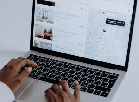
Today, cartographers use satellites, drones, and GPS systems to create detailed and accurate maps like never before.
When asking, “What is cartography?” It’s essential to note that it has evolved from an artistic process into a scientific and data-driven practice.
Advancements in Geographic Information Systems (GIS) and modern software have revolutionized mapping, enabling the development of interactive maps that showcase real-time data with remarkable precision.
These advanced tools help analyze patterns like traffic flow, population density, and land usage with greater precision and efficiency.
While traditional cartography focuses on static maps for navigation, today’s maps provide dynamic solutions for urban planning, disaster management, and even tracking climate change.
This evolution highlights the enduring significance of cartography in tackling the challenges of our increasingly complex world.
What are the main uses of cartography?
1. Navigation and Travel
Cartography is essential for creating maps that guide us in our everyday travel, from using GPS to finding new destinations.
Sailors, pilots, and drivers rely on accurate maps to travel safely and efficiently.
If you’ve wondered, “What is cartography?” one simple answer is that it helps us stay on course wherever we go.
2. Urban and Regional Planning
Cartography helps planners design better cities by mapping out roads, parks, and neighborhoods, providing a clear understanding of the urban landscape.
It’s also used to plan transportation systems and utilities, such as electricity or water lines.
Whether you’re managing a small area or a big city, asking, “What is cartography?” explains how maps are foundational to smart planning.
3. Disaster Preparedness and Management
Maps created through cartography are vital for identifying high-risk areas prone to floods, earthquakes, or hurricanes.
They allow emergency teams to prepare evacuation routes and distribute resources efficiently.
Understanding “What is cartography?” can save lives in times of crisis.
4. Scientific Research and Analysis
Scientists use cartography to study climate change, wildlife habitats, and population movements.
Maps offer a straightforward way to visualize complex data, transforming numbers into actionable insights.
Cartography merges science and creativity to present big ideas in simple, visual forms.
5. Real Estate and Land Management
Cartography enables landowners and investors to make informed decisions about property boundaries, zoning laws, and terrain conditions.
With detailed maps, investors can evaluate land value and development potential more effectively.
That’s why cartography is a key tool in the real estate world.
What types of maps do cartographers create?
Cartographers create a wide range of maps, each serving a distinct purpose.
General reference maps display physical features such as rivers, mountains, and cities, making them ideal for navigation and understanding geography.
Thematic maps are designed to highlight specific topics like population density, climate trends, or disease outbreaks, offering a robust solution for precise data analysis and interpretation.
Another category is navigational maps, like nautical or aeronautical charts, which sailors and pilots use to travel safely.
Cartographers also design topographic maps, which include detailed land elevations and features, often used by hikers and engineers.
Specialized maps, such as weather maps, offer real-time data on conditions like rainfall or temperature.
When considering the question “What is cartography?” it becomes clear that the field extends beyond basic mapmaking to encompass tools that inform and guide decisions in various industries.
These diverse maps are vital for a broad range of activities, from daily travel to complex scientific research.
Why learn about cartography for land investments?
- Understand Land Features Accurately: Cartography helps you visualize the physical features of a property, such as slopes, water bodies, or flat terrain. Knowing these details is essential when evaluating land for development or agriculture.
- Identify Property Boundaries: Using maps created through cartography allows you to define exact property lines and avoid disputes. It ensures you know which areas you’re legally purchasing from.
- Analyze Zoning and Regulations: Maps display zoning layouts, indicating the types of development permitted in a specific area. This knowledge can save time and money by preventing misinformed investments.
- Evaluate Accessibility: Cartography provides insights into nearby roads, transportation links, and utilities. Easy access to these can significantly impact the land’s value and usability.
- Assess Environmental Risks: Maps play a crucial role in identifying potential environmental risks, such as flood zones or areas prone to earthquakes. By leveraging detailed data, cartographers create maps that empower investors to make informed and safer decisions.
- Plan for Future Growth: Cartographic tools can show growth trends in population, infrastructure, and urbanization. This data helps you predict changes in land value and optimize your investments for the future.
- Make Well-Informed Decisions: By learning “What is cartography?” you’ll gain skills to interpret detailed maps and data confidently. This insight equips you to make informed and strategic decisions in land investments.
How can I start implementing cartography insights into my project?
Implementing cartography insights into your project starts with understanding how maps can solve your specific needs.
Begin by identifying your goals, such as analyzing land use, assessing environmental risks, or planning infrastructure.
Next, explore mapping tools like GIS (Geographic Information Systems) software to create or access detailed maps that suit your requirements.
If you’re unsure, start by answering the question, “What is cartography?” to familiarize yourself with the basics of mapmaking and its uses.
Work with professionals, such as cartographers or mapping consultants, to gain more accurate data and insights.
This ensures the maps align with your project’s objectives, whether it’s for urban planning, real estate investments, or disaster management.
Incorporate map-based findings into your strategy by highlighting key insights like accessibility, zoning, or growth trends.
Finally, keep maps updated regularly to reflect new data or changes on the ground.
By leveraging these steps, you can make smarter, more informed decisions.
Need help to get started? Book a free consultation with our team today to discover how cartography can enhance your project.
**NOTICE: Please note that the content presented in this post is intended solely for informational and educational purposes. It should not be construed as legal or financial advice or relied upon as a replacement for consultation with a qualified attorney or CPA. For specific guidance on legal or financial matters, readers are encouraged to seek professional assistance from an attorney, CPA, or other appropriate professional regarding the subject matter.